(VIDEO) Milwaukee Flood Warning: Heavy Rain Strands Drivers, Shuts Freeways as Storms Pound City
MILWAUKEE — A second consecutive night of heavy thunderstorms dumped up to 3 inches of rain across Milwaukee on Wednesday, triggering widespread street flooding, stranding motorists in rising waters and forcing full closures of major freeways including stretches of Interstate 43 and Wisconsin Highway 175.
The Milwaukee County Sheriff's Office reported multiple vehicles trapped in floodwaters as storms intensified between 7 p.m. and 11 p.m. April 15. Southbound Interstate 43 was fully closed at Becher Street due to flooding, with a northbound closure at Holt Avenue described as imminent. Additional shutdowns hit the Mitchell Interchange area and Brewers Boulevard near American Family Field, where flash flooding overwhelmed drainage systems shortly after a Brewers game.
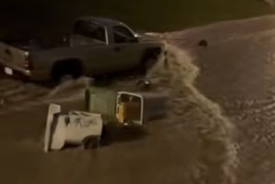
Emergency responders conducted water rescues as cars became submerged in low-lying areas and underpasses. Videos and eyewitness accounts showed vehicles stalled on Brewers Boulevard/Stadium Interchange, with water rising rapidly around tires and doors. Sheriff's deputies and Milwaukee Fire Department personnel pulled drivers to safety, emphasizing that no injuries were immediately reported despite the dangerous conditions.
The National Weather Service issued multiple flash flood warnings and a broader flood watch for southeast Wisconsin through Thursday morning. Saturated ground from earlier storms April 14 — which already brought 1 to 3 inches in many suburbs — left the region vulnerable to rapid runoff. Milwaukee has received more than 150% of its average April rainfall so far this month, with totals approaching 6 inches at Mitchell International Airport and higher amounts in outlying neighborhoods.
Wisconsin Department of Transportation traffic maps showed closures on northbound Highway 175 just before Interstate 94 and impacts along Interstate 94 itself. Commuters were urged to avoid travel as ponding water created hazardous conditions on surface streets, including Silver Spring Drive, Mill Road and areas near Timmerman Airport. In one northwest side incident, rapidly rising water at 97th Street and Hampton Avenue trapped several vehicles, prompting 911 calls and swift emergency response.
Marquette University issued campus alerts warning of flooding and potential water damage amid the downpours. The Milwaukee Metropolitan Sewerage District monitored for possible sewer overflows following the repeated heavy rainfall events, building on investigations from the previous night's storms.
The latest round of severe weather followed a pattern of active thunderstorms across the Midwest. Earlier on April 15, severe thunderstorm watches and warnings covered portions of Milwaukee, Waukesha, Racine and other counties, with threats of nickel-size hail, wind gusts up to 60 mph and isolated tornado activity. While no new tornadoes were confirmed Wednesday night, the primary danger shifted quickly to flooding as storms trained over the same saturated areas.
Authorities repeatedly warned residents: "Turn around, don't drown." Just six inches of moving water can sweep away most vehicles, and deeper flooding poses life-threatening risks. The sheriff's office posted urgent alerts on social media, stating, "With flooding all across Milwaukee County, people are getting stuck in their vehicles. Full freeway closures are also underway."
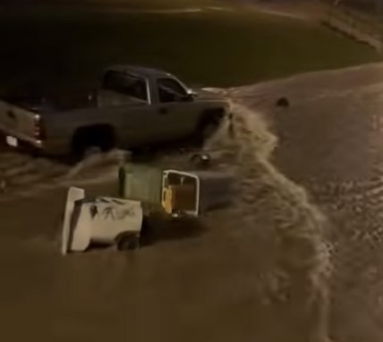
Impacts extended beyond roadways. Street flooding swept away trash bins in some neighborhoods, and low-lying parks and golf courses reported standing water. The combination of urban development and overwhelmed storm sewers exacerbated ponding in residential and commercial districts.
This week's weather has strained local resources. The Milwaukee Fire Department handled dozens of water rescue calls over two nights, with Chief Aaron Lipski noting the department's heavy workload. Power outages affected thousands in some earlier storms, though Wednesday's focus remained on flooding rather than widespread wind damage.
Meteorologists attribute the persistent heavy rain to a stalled weather pattern bringing repeated rounds of moisture from the south. An additional 1 to 2 inches fell in spots during the Wednesday evening storms, pushing some neighborhoods toward flash flood thresholds. The National Weather Service canceled severe thunderstorm watches late Wednesday but maintained flood concerns into Thursday morning, with isolated showers possible during the morning commute.
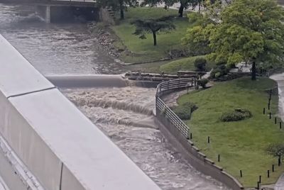
Looking ahead, forecasters predict drier and cooler conditions Thursday with highs in the 50s, offering a brief respite. However, another line of strong storms could approach Friday night, potentially bringing more rain to an already soaked region. Long-term river flooding remains a concern along waterways like the Menomonee River and Sheboygan River in parts of the state.
Milwaukee officials encouraged residents to report street flooding by calling 414-286-CITY. The Wisconsin Department of Transportation advised checking 511wi.gov for real-time road conditions, closures and traffic camera feeds before traveling.
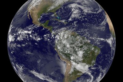
The back-to-back flooding events highlight vulnerabilities in Milwaukee's aging infrastructure amid increasingly intense spring weather patterns linked to broader climate trends. Heavy April rains have become more common, overwhelming systems designed for historical averages.
Community response included neighbor-assisted rescues and widespread sharing of safety messages on social media. Local media outlets provided live updates, with drivers sharing videos of submerged cars near American Family Field and I-43 ramps.
No widespread structural damage was immediately reported from Wednesday's flooding, but officials warned of potential basement flooding and sewer backups in low-lying homes. Insurance claims for water damage are expected to rise following this week's storms.
As crews worked overnight to clear debris and reopen roadways, some sections of I-43 began reopening by late evening, though conditions remained dynamic. The Mitchell Interchange area saw partial recovery, but drivers were cautioned to expect delays and standing water into Thursday.
This episode marks the latest in a series of severe weather impacts across Wisconsin in mid-April 2026. Earlier storms on April 14 produced hail, high winds and confirmed tornadoes in other parts of the state, leveling homes and damaging churches in Juneau and Waukesha counties.
Gov. Tony Evers has monitored the situation closely, with state emergency management coordinating support for affected counties. The combination of urban flooding and highway disruptions has disrupted evening commutes and post-game traffic near downtown venues.
Experts recommend preparing emergency kits with flashlights, charged phones and evacuation plans for low-lying areas. Drivers should avoid flooded roads entirely, as hidden hazards like washed-out pavement or debris can turn minor flooding deadly.
For Milwaukee residents, the message from authorities remains clear: Stay off the roads during heavy downpours, monitor weather alerts and prioritize safety over schedules. As the region dries out Thursday, attention will turn to assessing any lingering infrastructure issues and preparing for potential additional rain later in the week.
The National Weather Service continues to track the evolving pattern, urging vigilance. With April only halfway complete and rainfall totals already well above normal, southeast Wisconsin faces an elevated risk of further flooding this spring.
Local leaders and emergency managers stress the importance of infrastructure investments to handle heavier precipitation events. In the meantime, residents are advised to heed warnings and allow first responders to focus on those truly in need.
As of early Thursday, most major closures had eased, but officials continued monitoring for new flooding as residual showers moved through. The full extent of property impacts and any additional rescues will become clearer with daylight.
Milwaukee's experience reflects broader Midwest challenges this week, where saturated soils and repeated thunderstorms have tested communities from Wisconsin to Illinois and beyond.
© Copyright 2026 IBTimes AU. All rights reserved.
- Recommended For You