(VIDEO) Sierra Nevada Winter Storm Warning 2026: Up to 5 Feet of Snow Shuts Roads, Threatens Travel
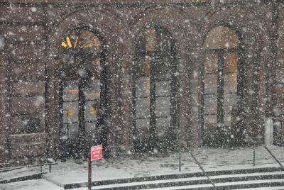
SACRAMENTO, Calif. — A powerful late-season winter storm slammed the Sierra Nevada on Saturday, prompting active Winter Storm Warnings across Northern California's mountain ranges as heavy snow, strong winds and whiteout conditions made travel dangerous or impossible on major highways including Interstate 80, U.S. Highway 50 and routes near Lake Tahoe.

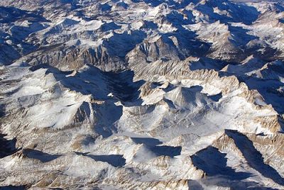
The National Weather Service in Sacramento upgraded an earlier Winter Storm Watch to a full Warning for the West Slope of the Northern Sierra Nevada and Western Plumas County, effective from Friday evening through Sunday night, with some advisories extending into Monday. Forecasters warned of widespread accumulations of 1 to 2 feet of snow above 4,500 feet, with 2 to 5 feet possible above 6,000 feet and locally higher amounts at peaks. Snow levels dropped sharply to as low as 4,000-4,500 feet, bringing heavy wet snow to lower elevations.
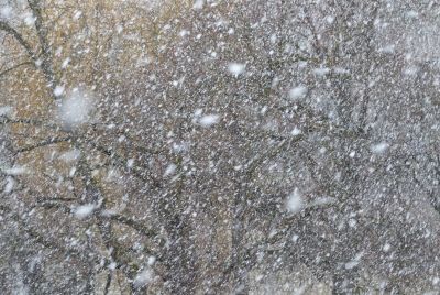
Wind gusts reached 50-55 mph in the mountains, with isolated higher gusts up to 80-90 mph on exposed ridges, creating blizzard-like conditions and near-zero visibility at times. The storm, fueled by back-to-back upper-level lows from the Pacific with precipitable water values 150-200% of normal, intensified through Saturday and was expected to continue impacting the region into Sunday evening.
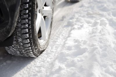
Caltrans reported widespread chain controls and multiple road closures Saturday as snow accumulated rapidly on passes. Donner Pass on I-80 saw heavy snow and gusty winds, leading to difficult or impossible travel in spots. Similar conditions affected Highway 50 over Echo Summit and routes near Yosemite and Lassen Park. Officials urged drivers to delay all non-essential travel, carry emergency supplies and use extreme caution if venturing into the mountains.
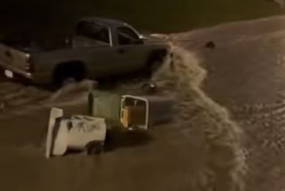
In Western Plumas County and areas around Quincy, Chester and Blue Canyon, the heaviest snow fell overnight Friday into Saturday, with rates heavy at times. NWS forecasters noted the potential for 3-4 feet or more at the highest elevations, including popular ski resort areas. Lower elevations in the Sierra foothills saw a mix of rain turning to snow, while the Sacramento Valley remained under a Flood Watch due to heavy rainfall.
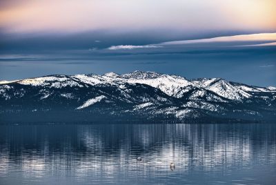
The Reno NWS office issued its own Winter Storm Warning for the Greater Lake Tahoe area and eastern Sierra slopes, effective Saturday afternoon through Sunday night. Accumulations of 2-8 inches were forecast below 8,000 feet, with 6-12 inches or more above that level. Winds gusting to 80 mph raised concerns for tree damage, power outages and blowing snow.
This unusual April storm arrived after weeks of warmer, drier conditions, catching some residents and visitors off guard as spring activities were underway. Ski resorts in the region, already winding down their seasons, saw an unexpected boost in snow but also operational challenges from high winds and heavy accumulations. Some lifts were temporarily halted for safety.
Emergency management officials in counties from Lassen to Placer activated cold-weather protocols and opened warming centers where needed. Power utilities reported monitoring for outages caused by wind and wet snow loading on lines. In lower elevations, the combination of rain and melting snow raised minor flood risks in burn scar areas from previous wildfires.
Travelers heading to or from Reno-Tahoe International Airport or crossing the Sierra faced significant delays. Airlines reported some cancellations and ground stops due to mountain weather. Amtrak's California Zephyr route, which traverses the Sierra, experienced disruptions.
The storm system is part of a broader pattern of active Pacific weather affecting the West Coast. While beneficial for California's snowpack — which had been running below average in some areas — the timing created hazards for hikers, campers and those planning outdoor spring events. NWS meteorologists emphasized that even modest accumulations at mid-elevations could make unpaved roads impassable.
As of Sunday morning, April 12, the warnings remained in effect with the most intense snowfall tapering but lingering showers and gusty winds continuing. Additional accumulations of several inches were still possible in higher terrain before the system fully exits. Forecasters anticipated gradual improvement by Monday, with drier and milder conditions returning mid-week.
Residents and visitors were reminded to check Caltrans QuickMap and NWS forecasts frequently. Key safety tips included packing chains or snow tires, carrying extra food, water and blankets, and informing others of travel plans. Avalanche danger rose with the heavy new snow on top of existing base in some areas.
This late-season event highlights the Sierra Nevada's reputation for dramatic weather swings even in April. Similar powerful spring storms have occurred in past years, sometimes delivering record snow while disrupting travel and infrastructure.
State and local agencies coordinated responses, with Caltrans crews working around the clock to clear and treat roads. In Plumas and Sierra counties, officials advised staying indoors during the peak of the storm if possible, especially in rural areas.
The heavy precipitation also brought a chance of thunderstorms, adding lightning and brief heavy downpours to the mix at lower elevations. As the snow levels rose again late Sunday, rain was expected to dominate below 5,000-6,000 feet.
For many Californians, the storm provided a stark reminder that winter conditions can return abruptly in the mountains. While the moisture helps replenish reservoirs and snowpack ahead of the dry summer months, the immediate impacts on transportation and safety dominated concerns this weekend.
As conditions evolve, authorities continue to monitor the situation closely. Travelers should prepare for lingering impacts even after warnings expire, including slushy or icy roads in shaded areas and potential debris on highways.
The Sierra Nevada's 2026 late-season storm has delivered a dramatic dose of winter weather, testing preparedness and reminding residents and visitors alike of the range's formidable power.
© Copyright 2026 IBTimes AU. All rights reserved.
- Recommended For You