‘Weak’ El Niño 2014 to Start In 4-8 Weeks
The El Niño weather phenomenon that forecasters had anticipated for so long will begin in the next four to eight weeks. It will, however, be a weak one, much to the chagrin of drought-stricken California.
The National Weather Service's Climate Prediction Center on Thursday said the El Niño, which was first announced early this year, would be happening in a month or two. Forecasters expect it to continue until into spring. But while forecasters agree there is a 2-in-3 chance of El Niño happening between November 2014 to January 2015, it will "likely remain weak ... throughout its duration."
An El Niño occurs when sea surface temperatures hit more than 0.5 degrees Celsius during the long term average. Presently, sea surface temperatures are only up by 0.3 degrees.
As early as January 2014, Australian and U.S. weather forecasters warned an El Niño weather pattern may hit the country and parts of Asia this year, potentially giving headaches to farm growers as they brace for deficient rains. Even Skymet Weather Services, a Delhi-based weather forecaster, predicted the El Niño year will happen through the monsoon months of June, July, August and September.
June came, nothing happened. Come July, Australia's Bureau of Meteorology said the occurrence of a 2014 El Niño has eased. From an initial 80 percent in June, forecasters now predicted a 50 percent chance of it ever forming at all. However, the BoM said that despite the easing, the phenomenon could still occur before year's end. "Warmer-than-average waters persist in parts of the tropical Pacific, and the (slight) majority of climate models suggest El Niño remains likely for spring," the bureau had said earlier in July. "Hence the establishment of El Niño before year's end cannot be ruled out. If an El Niño were to occur, it is increasingly unlikely to be a strong event."
El Niño is often associated with wide scale below-average rainfall over southern and eastern inland areas of Australia and above-average daytime temperatures over southern Australia. Similar impacts prior to the event becoming fully established regularly occur.
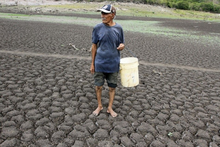
The irregularities not only happen in Australia. The El Niño weather pattern can cause both floods and drought in other parts of the globe as well.
Earlier in the year, scientists predicted this particular El Niño will come in close to the one that occurred in 1997-1998 when sea surface temperatures reached 2.4 degrees. This weak El Niño will occur to reach only 1.6 degrees above normal, similar to the 2009/10 event.
- MOST POPULAR IN Society