Weather Alert: Atlantic Canada Advised to Brace for Hurricane Gonzalo, What and How to Prepare
Residents in the Canadian province of Newfoundland and Labrador are being advised to take all necessary precautions as Hurricane Gonzalo makes headway for the region. The tropical storm is expected to make landfall in Newfoundland on Saturday night.
Residents were advised to prepare for possible widespread power outages, downed trees and branches. Large waves as high as anywhere from six to eight metres could also develop.
Brett Anderson, a meteorologist with AccuWeather, said the southeast coast of Newfoundland could experience sustained winds between 85 to 110 km/h with gusts up to 120 to 150 km/h on late Saturday well going into the night. The St. John's area, on one hand, could have sustained winds of 60 to 90 km/h, with wind gusts up to 95 to 120 km/h.
He said the Gonzalo's impacts will be felt on Saturday evening across the eastern half of Newfoundland, with "little or no impacts for the western half." This is because Gonzalo is a fast-moving storm. Its' duration is expected to occur from six to eight hours max once it passes through the forecast areas of impact.
The Fire and Emergency Services-Newfoundland and Labrador (FES-NL) advised the public to monitor local weather forecasts, prepare a 72 hour emergency kit as well as develop an emergency plan.
Some important sites to visit now while preparing:
- Public Weather Alerts for Newfoundland and Labrador
- Get Prepared
- Emergency Preparedness
- Insurance coverage
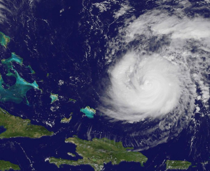
Gonzalo, moving nine miles per hour and with maximum sustained winds of about 220 km/h, is currently 830 kilometres south-southwest of Bermuda island, which is forecast to receive a near-direct-hit, based on computer models. Maintaining its Category 4 intensity based on the Saffir-Simpson Hurricane Wind Scale, it is expected to strike Bermuda by Friday afternoon. The Hurricane Center warned Bermuda to brace for "dangerous and life-threatening storm surges" since its damaging winds may reach over 100 miles per hour.
The Hurricane Center said in a statement Gonzalo will be "a dangerous hurricane when it moves near Bermuda." The island's resident agency forecaster, the Bermuda Weather Service, has issued a warning of a "direct hit."
"Those with elevated and exposed, or south-facing residences will receive the brunt of Gonzalo's winds, as they begin southeasterly Friday morning as strong tropical force strength. These winds continue to ramp up, and veer southerly through southwesterly as Gonzalo passes," the weather service said.
- MOST POPULAR IN Politics & Policy