Magnitude 5.8 earthquake rocks Queensland, 15 aftershocks follow
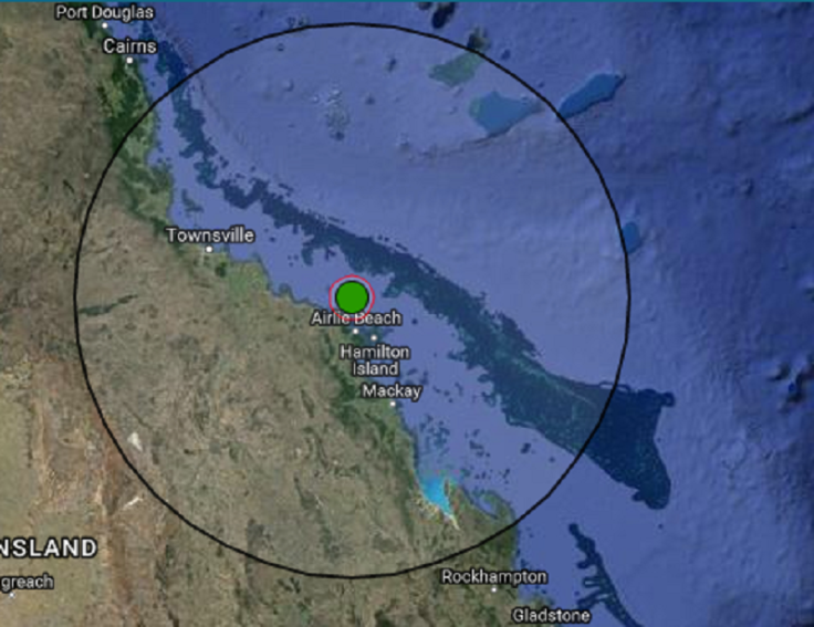
A magnitude 5.8 tremor hit north Queensland on Thursday at 2:30 pm (AEST), about 70 kilometres off the coast of Bowen. Geoscience Australia has since then recorded 15 aftershocks.
The latest aftershock, a magnitude 3 temblor, was recorded a 7:37 am on Friday, preceded by a magnitude 4.1 aftershock at 4:27 am, reports Yahoo News. Although the magnitude of the Bowen earthquake was significant, Jonathan Bathgate, senior seismologist at Geoscience Australia, says it was not the biggest in Australia in recent years.
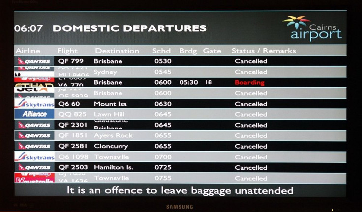
Cairns Post reports that buildings were evacuated and flights to Cairns diverted following the earthquake. Three flights were delayed and another three diverted to Townsville, while 12 control tower employees at Cairns Airport were evacuated. Employees of the Torres and Cape Hospital and Health Service office were likewise evacuated.
The tremor was felt up to north as Cairns, south as far as Maroochydore and west of Charters Towers. Dr Huilin Xing, a University of Queensland earthquake researcher, thinks it was one of the largest to rock northern Queensland.
There is apparently little or no damage across the region. “With an earthquake that big, I thought there might be property damage, but it doesn’t look like it anywhere … (the buildings) are built stronger than in other regional areas because sometimes the cyclones cause more damage than earthquakes,” Huilin explains.
Bathgate adds the Northern Territory earlier recorded a magnitude 6.1 tremor, the largest earthquake to hit Australia in 20 years. But he points out it has been “an active 12 months for earthquakes in Australia.”
VIDEO: Earthquake in Queensland, North-East of Bowen
Source: Greenshack Dotinfo
- MOST POPULAR IN Science