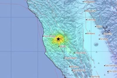
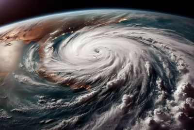
California, which just received a whopping 10 trillion gallons of rainwater on Thursday, is in for more this week. However, weather experts said the looming rainwater won't be as much as the last one.
Bob Benjamin, National Weather Service forecaster, said the Bay area is due for a second storm in less than a week. But the approaching weather system will only dump an inch or two inches of rain in the San Francisco Bay and Sacramento regions on Sunday night through Monday morning. It will move towards Southern California. Less rain is expected for Los Angeles.
He said it is going to be a wet early morning day for commuters, with no exemptions even for school goers. "It's not going to be as significant as we experienced last Thursday," Mercury news quoted Benjamin. "This one won't keep the kids home from school," he said.
The Thursday storm was the Bay Area's largest storm in five years. According to NBC Los Angeles, citing an unidentified meteorologist, it had dumped 10 trillion gallons of rainwater which was enough to power Niagara Falls for 154 days.
Still, Aaron Baker, Raw Water Operations director, said the rainfall wasn't enough. "We were expecting more on the order of 10,000-acre feet, but the upper watersheds are so dry and the storm didn't produce quite the amount of rainfall that we were hoping for."
A second weather front could bring more rain on Wednesday in the region, Benjamin said. Southern California on Thursday may experience more rain.
Combined, the two weather systems aren't expected to bring in the rains the region badly needs. Although both could bring gusty winds, Benjamin said temperatures are expected to be relatively mild.
Benjamin said Thursday's storm and the approaching potential back-to-back ones are typical at this time of the year. "The storm door opens up, and we might get a major one along with a steady progression of weather systems. Right now, the atmosphere is unsettled and you don't have the high pressure keeping anything out," he said.
A large cloud gathers over the skyline of San Francisco, California December 12, 2014. A major storm pummeled California and the Pacific Northwest with heavy rain and high winds on Thursday, killing one man, knocking out power to tens of thousands of homes, disrupting flights and prompting schools to close. REUTERS/Robert GalbraithREUTERS/Robert GalbraithCars make their way along the coastal highway 101 as a winter storm clears in Solana Beach, California December 12, 2014. REUTERS/Mike BlakeREUTERS/Mike BlakeHomeowner Elton Gallegly walks through his home after a mud slide came down on at least 8 homes during heavy rains in Camarillo Springs, California, December 12, 2014. A majorstorm that pummeled northern California and the Pacific Northwest with heavy rain and high winds and killed two people moved south overnight, prompting evacuation orders in areas prone to floods and mud flows. The National Weather Service forecast the system to track through southwestern California late on Thursday and into Friday, bringing the possibility of strong thunderstorms, as well as waterspouts and small tornadoes along the coast. REUTERS/Jonathan Alcorn REUTERS/Jonathan AlcornA group of houses are pictured after boulder-strewn rivers of mud swept down hillsides during a winter storm, in Camarillo Springs, California December 12, 2014. A Pacific storm pounded Southern California with heavy rain and high winds on Friday, triggering flash floods and mudslides that prompted the evacuation of hundreds of homes, damaged dozens of others and disrupted passenger rail service along the coast. One of the areas hardest hit on Friday was the community of Camarillo Springs, north of Los Angeles. Reuters/Mario AnzuoniRocks reach the roof of a home after a mudslide overtook at least 8 homes during heavy rains in Camarillo Springs, California, December 12, 2014. A majorstorm that pummeled northern California and the Pacific Northwest with heavy rain and high winds and killed two people moved south overnight, prompting evacuation orders in areas prone to floods and mud flows. The National Weather Service forecast the system to track through southwestern California late on Thursday and into Friday, bringing the possibility of strong thunderstorms, as well as waterspouts and small tornadoes along the coast. REUTERS/Jonathan AlcornREUTERS/Jonathan Alcorn