Hurricane Arthur, the first hurricane of the 2014 Atlantic hurricane season, has forced the relocation of thousands in North Carolina as weather forecasters said it could reach Category 2 storm before it even makes landfall.
As of 7 pm CDT, Arthur's center was seen 45 miles east of Cape Fear, N.C., moving north-northeast at 15 mph. A Category 2 storm has winds from 96-110 mph.
On Thursday evening, hurricane warnings were issued along the North Carolina coast up to the Virginia border, while tropical storm warnings were issued as far north as Nantucket Island and Cape Cod in Massachusetts.
A report from WRAL.com said four refueling aircraft and more than 50 F-15 Strike Eagles have been moved from Seymour Johnson Air Force Base to Wright-Patterson Air Force Base in Ohio to avoid possible high wind damage from Hurricane Arthur.
Mike Maze, a WRAL meteorologist, said many have left the coast area, heeding storm warnings. He said one viewer reported heavy traffic along U.S. Highway 70 in Goldsboro, the main highway between Morehead City and Raleigh.
Still, there are many who remained stubborn to warnings.
"It's fun, it's not that bad," a resident told NBC.
Storm surges as high as three to five feet could lash out areas in the Carolinas and Virginia, the National Hurricane Center said.
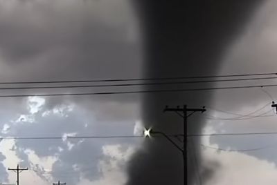
It noted the possibility of tornadoes in some areas. Parts of North Carolina could receive as much as six inches of rain.
Bob Robichaud, Canadian Hurricane Centre meteorologist, said hurricane Arthur will bring in a windy and wet weekend for Nova Scotia, as forecasters expect the system to weaken as it moves north and become a strong post-tropical storm when it strikes Canadian soil late Friday or early Saturday.
"In terms of the worst wind, it looks like Nova Scotia and in terms of the worst rain it looks like New Brunswick," he told the Associated Press.
The U.S. Coast Guard light station located 34 miles off the North Carolina coast released this video (here) showing what Hurricane Arthur sounds like.
The eye of Hurricane Arthur is seen over the Atlantic in this photo from the International Space Station tweeted by European Space Agency astronaut Alexander Gerst July 3, 2014. The first hurricane of the Atlantic season gained strength on Thursday as it spun toward the North Carolina coast on the verge of Category 2 status, forcing thousands of vacationers to scrap their July Fourth holiday plans amid evacuation orders. REUTERS/Alexander Gerst/NASA/Handout via Reuters (OUTER SPACE - Tags: ENVIRONMENT SCIENCE TECHNOLOGY TPX IMAGES OF THE DAY) ATTENTION EDITORS - THIS PICTURE WAS PROVIDED BY A THIRD PARTY. REUTERS IS UNABLE TO INDEPENDENTLY VERIFY THE AUTHENTICITY, CONTENT, LOCATION OR DATE OF THIS IMAGE. THIS PICTURE IS DISTRIBUTED EXACTLY AS RECEIVED BY REUTERS, AS A SERVICE TO CLIENTS. FOR EDITORIAL USE ONLY. NOT FOR SALE FOR MARKETING OR ADVERTISING CAMPAIGNSREUTERS/Alexander Gerst/NASA/HDavid Laing of Myrtle Beach waits for good waves from Hurricane Arthur, at Ocean Isle Beach, North Carolina July 3, 2014. Arthur threatens to douse some July 4 holiday plans on the U.S. East Coast as officials ordered evacuations of some low-lying coastal areas, closed beaches and tourist sites and delayed fireworks shows in anticipation of heavy rain and fierce winds. REUTERS/Randall Hill (UNITED STATES - Tags: ENVIRONMENT SOCIETY)REUTERS/Randall HillChildren play on the banks of the Charles River as officials prepare to celebrate Independence Day a day early in Boston, Massachusetts July 3, 2014. The celebrations were moved for the first time since 1992 due to the developments of Hurricane Arthur on the U.S. east coast. REUTERS/Dominick Reuter (UNITED STATES - Tags: ANNIVERSARY POLITICS SOCIETY ENVIRONMENT)REUTERS/Dominick ReuterTourists take photos of the surf from their beach houses during Hurricane Arthur, on the west end of Ocean Isle Beach, North Carolina July 3, 2014. REUTERS/Randall HillREUTERS/Randall HillMegan O'Niell and Jackie Pugsley (R) snap a selfie with an American flag-clad phone as officials prepare to celebrate Independence Day a day early in Boston, Massachusetts, July 3, 2014. The celebrations were moved for the first time since 1992 due to the developments of Hurricane Arthur on the U.S. east coast. REUTERS/Dominick Reuter (UNITED STATES - Tags: ANNIVERSARY POLITICS SOCIETY TPX IMAGES OF THE DAY)REUTERS/Dominick ReuterA "No Swimming" sign is pictured at Myrtle Beach State Park in preparation for the arrival of Hurricane Arthur, in Myrtle Beach, South Carolina July 3, 2014. Arthur became the first hurricane of the 2014 Atlantic season on Thursday after sparking evacuations, closing beaches and tourist sites and disrupting Independence Day celebrations along parts of the U.S. East Coast. REUTERS/Randall Hill (UNITED STATES - Tags: ENVIRONMENT DISASTER)REUTERS/Randall HillREFILE - CORRECTING GRAMMARVehicles make their way north on Highway 12 during an evacuation ahead of Hurricane Arthur in Pea Island, North Carolina July 3, 2014. The first hurricane of the Atlantic season gained strength on Thursday and is expected to attain Category 2 status as it reaches the North Carolina coast, where thousands of vacationers scrubbed their July Fourth holiday plans amid evacuation orders. REUTERS/Chris Keane (UNITED STATES - Tags: ENVIRONMENT TRANSPORT SOCIETY)REUTERS/Chris KeaneStorm clouds fill the sky as Hurricane Arthur looms offshore, in Myrtle Beach, South Carolina July 3, 2014. Arthur became the first hurricane of the 2014 Atlantic season on Thursday after sparking evacuations, closing beaches and tourist sites and disrupting Independence Day celebrations along parts of the U.S. East Coast. REUTERS/Randall Hill (UNITED STATES - Tags: ENVIRONMENT DISASTER)REUTERS/Randall HillMaryline Epping of Avon, North Carolina finishes the words on a sign out in front of her shop before Hurricane Arthur in Buxton, North Carolina July 3, 2014. The first hurricane of the Atlantic season gained strength on Thursday and is expected to attain Category 2 status as it reaches the North Carolina coast, where thousands of vacationers scrubbed their July Fourth holiday plans amid evacuation orders. REUTERS/Chris Keane (UNITED STATES - Tags: ENVIRONMENT SOCIETY)REUTERS/Chris Keane