Atlantic Canada Suffers Lethal Spring Blizzard, Worse Conditions Expected
The East Coast in Canada has been paralyzed by an enormous spring blizzard. Strong winds along with heavy snow disrupted normal life. Also, there were warnings of continuing storm.
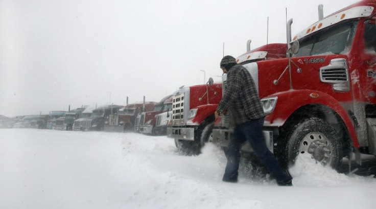
CTV News reported Nova Scotia started getting affected by blizzard conditions on Wednesday morning. It forced government offices and schools to cancel their sessions. Bus and ferry services were also canceled. There were strong winds causing severe power outages. Eventually over 2,800 customers of Nova Scotia Power in Liverpool and Shelburne areas got affected. There can be further intensification of winds in the afternoon, which may prompt near-zero visibility on the road. Warnings have been issued regarding the visibility.
Environment Canada issued high winds, storm surges and blizzard warnings for most part of the Atlantic provinces. Prince Edward Island and Nova Scotia are expected to experience the maximum amount of snow fall. It could be as much as 50 cm in a few areas. Environment Canada also issued warnings about near-zero visibility and gust winds which were forecast to hit as high as 120 km/h.
Officials in Nova Scotia warned motorists not to hit the roads. They issued warnings for people residing in low-lying areas expected to suffer storm surges. Sean Irvine from the Emergency Management Office of Nova Scotia spoke to CTV Atlantic.
He said an expected storm surges would coincide with high tide. Labrador, Newfoundland and New Brunswick are seen to suffer less amount of snow. But these areas are going to experience stronger winds which might cause widespread power outages and whiteout conditions. Gust winds might reach 160 km/h while it might reach 180 km/h in the Wreckhouse area, according to Environment Canada.
The Maritimes is expected to see the worst of the storm on Wednesday afternoon. It may continue in the evening. According to meteorologists, the storm effects could last several days as there would be flurries and high winds on Thursday and Friday. Several flights have been canceled due to the conditions in Halifax and Fredericton airports.
window.NREUM||(NREUM={});NREUM.info={"beacon":"beacon-2.newrelic.com","licenseKey":"530c5b0e18","applicationID":"2665226","transactionName":"MVEBZBZSD0dZBkJaDggbNkINHANdQkpGXxQBXQ1DS1YFXUwKRBwLFVcRWRRHEhtMDFhKPgtXBh8UXxRTUQtFHBEHRxdVS1ENVVYOGFsVCw==","queueTime":0,"applicationTime":0,"ttGuid":"","agentToken":"","userAttributes":"","errorBeacon":"jserror.newrelic.com","agent":"js-agent.newrelic.com/nr-356.min.js"}
// -->
- MOST POPULAR IN Science