

Meltwater Drainage Explains Missing Runoff On Greenland’s Ice Sheet
Melting glaciers and ice sheets have been identified as some of the main contributors to rising sea levels. Greenland's extensive ice sheet is a great source of meltwater runoff that adds to this phenomenon. A new research suggests that a great network of little-known waterways on the surface of the ice sheet could contribute more to sea-level rise than melt water from glaciers and global warming. Scientists from the University of California in Los Angeles (UCLA) and the City College of New York have examined the Isortoq River and other fascinating structures on the ice sheet.
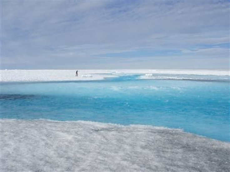
The research team observed more than 500 rivers and streams in the southwest area of Greenland's ice sheet. While studying glacial processes in the summer of 2012, UCLA researchers observed how meltwater from the ice sheet flowed. A bigger portion poured into the rivers and streams while some amounts sank into the thick ice sheet. Great runoffs flowed through the land, and while the rest emptied into enormous ice holes straight to aquifers under the ice sheet. It appears that freshwater flows to the Isortoq River and is released into the sea. However, 25 percent is absorbed in the ice holes instead of flowing into the ocean. Scientists saw how the rivers gushed into these large drainage holes called moulins in just less than 30 minutes. Tracking equipment were hurled into the holes to determine where the water has gone. The surface water engulfed by these moulins remained underneath, and so did the tracking devices.
The researchers say that the water that has disappeared turns out to be contained in an enormous aquifer or water reservoir beneath the ice sheet. This reservoir spreads over 69,930 square kilometres, according to NASA's Operation Icebridge radar data. Although the water remained there for some time, it flowed out after more than a year. Findings in this research emphasises the need for observing actual processes to improve climate models being used to study global warming. This study was published on Jan 12, 2015 in the Proceedings of the National Academy of Sciences.
There have been previous explorations on Greenland's ice sheet and attempts to know more about the complex structure and nature of these drainage holes and how they influence the waterways. Also, the discovery of Greenland's aquifer in 2011 has led to more studies on how melt water flows through the surface and how it could cause rise in sea level.


