

El Nino likely passing its peak in Australia may mean relief for bushfire ravaged communities
El Nino’s grip on the nation has likely reached its peak, according to oscillation indicators from the Bureau of Meteorology (BOM), paving the way for a potentially wetter second half of 2016.
Tropical Pacific Ocean temperatures have indicated this current El Nino has been one of the top three strongest events in the past 50 years, but current climate models from past seasons suggest dry skies and harsh winds from the 2015-16 event will decline in coming months.
The predictions come after the BOM announced that rainfall was well below average in parts of all states, with warmer than average temperatures recorded across the country.
Acting Assistant Director for Climate Information Services, Dr Scott Power detailed how the temperatures had ranked 2015 as the fifth warmest year on record for Australia
“The national mean temperature was 0.83°C above average, with a number of notable heatwaves during the year and record-breaking temperatures from October to December,” he said.
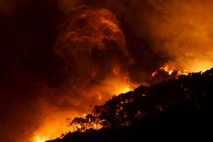
The weather phenomena is part of a natural cycle that causes El Nino to warm, or La Nina to cool parts of the central and eastern Pacific Ocean. Decreased rainfall and increased bushfire risk in Australia are a direct result of the Pacific warming, while cooling delivers increased tropical cyclone numbers and rainfall.
Temperatures are still expected to remain at strong levels in January, despite the central to eastern tropical Pacific Ocean sea surface and sub-surfaces cooling in recent weeks. Coupled with recent bursts of westerly winds over the western-equatorial Pacific, the decline of El Nino may temporarily slow.
Dr Andrew Watkins, Manager of Climate Prediction Services at the BOM told IBT that heat below the surface of the Pacific Ocean “acts like the flywheel,” giving momentum to an event like El Nino.
“That heat should be dissipating now,” he said.
“We are probably at or have just past the peak and we will see this slow decline for the next several months.”
Close to 60 percent of El Nino events will return to neutral conditions by the second half of 2016 based on analyses of the 26 past events since 1990.
According to the El Nino Southern Oscillation (ENSO) index, there is still a 40 percent chance the formation will develop into the wet-weather phenomenon La Nina.
“We’re expecting things to not return to neutral until the second quarter of 2016,” Dr Watkins said. “After that, it is a little bit of a fifty-fifty call in some ways.”
Models from the BOM and past analyses of these weather phenomena have suggested neutral and La Nina patterns are equally likely for the second half of the year.
“Neutral conditions and La Nina are at similar odds, regardless of whether you look at the models… or if you look at history,” he said.
“History tells us… 40 percent of the time you go into La Nina, and 60 percent of the time you go to neutral conditions after… an El Nino.”
The least likely scenario according to Dr Watkins is that weather conditions return back to an El Nino event.
-

Nepalis Fight TikTok Ban In Court, Or Ignore It Entirely
-

The Moroccans Who Fought For France And Settled In Vietnam
-

Georgia Pro-EU Protesters Erect Barricades Outside Parliament After Crackdown
-

Judge Threatens Trump With Jail Over Gag Order Violations
-

Student Protesters Hunker Down As More Unrest Rocks US Campuses


