

Australia unveils world’s ‘most advanced weather satellite’ for better weather forecasting
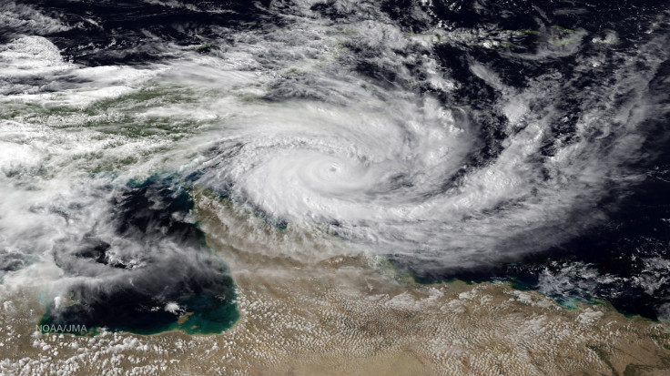
The Bureau of Meteorology has announced an innovation in Australia’s weather forecasting with the use of the most advanced weather satellite in the world, the Japanese Himawari-8 satellite. The Bureau has successfully made near real-time imagery of Australia through the newly launched satellite.
Himawari-8 can provide data nearly 50 times greater than the Bureau’s previous satellite, which will allow forecasters to access 16 observation wavebands and capture significant details from various layers of the atmosphere. Before the innovation, the Bureau was only able to receive single satellite image every hour, but the new satellite can provide detailed scan of Australia every 10 minutes to report the conditions on Earth.
The satellite will offer enormous benefits, said Bureau Director and CEO Dr Rob Vertessy. Himawari-8 was described as “one giant leap in satellite meteorology,” which Vertessy compared the development as “switching from black and white TV to high definition colour in one jump.”
Himawari-8 will work with the coming upgrade of the Bureau’s supercomputer. Vertessy said the combined functions of the Himawari-8 and the new weather computer will improve forecasts with more accurate data.
“Our forecasters are now starting to make use of the vast quantity of new data,” he said in a press release. One of the benefits the country may expect is the technology’s ability to see developing storms, Vertessy added.
The real-time images from the Himawari-8 are freely available to the public. Vertessy has expressed gratitude to the Japan Meteorological Agency for providing the data during the launch of the satellite.
“There is a wonderful tradition of global cooperation in meteorology. The Japan Meteorological Agency is making a big investment in Himawari-8, close to a billion Australian dollars, and the Australian community can share the benefits,” he said.
The Himawari-8 images can be viewed through the Bureau's web viewer, currently under a period of testing after its initial release on Sept. 30. The Bureau is hoping for feedback to further improve the Web viewer scfound on the Bureau’s Web site.
“This is a great day for the Bureau of Meteorology and all Australians who have an interest in weather,” Vertessy said. The Bureau is expecting for further growth of the use of the data over the coming years, he added.
Contact the writer at feedback@ibtimes.com.au or tell us what you think below


